


davey_83
-
Posts
7,178 -
Joined
-
Last visited
Content Type
Profiles
Forums
Events
Gallery
Store
Everything posted by davey_83
-
Why so? I see it as a straight forward question based on what a person look towards in terms of truth. A lot of people don't entertain faith due to its lack of evidence, therefore I asked if the correct amount of proof was given would that be enough? I await the yes/no answer and I kindly ask it of you.
-
No. I don't believe you know what you are asking. Part of Islam is JC, so if theres no JC as a whole you maybe look elsewhere. Also faith isnt based on scientific knowledge, so my question is relevant to a non believer.
-
lol Muslims believe in Jesus so................
-
I don't have a problem at all with microevolution (just a name) its macroevolution, ie a dog changing into a rabbit, a rabbit into a sheep I see no demonstrable evidence for. Again micro affects humans, ie one type of species so no bother there. The bible account for day one of creation, so I don't really see it as modern? What's the origin of God? to answer it wasn't long ago (60 ish years ago) science thought the universe was infinite having always existed, so its ok for that to be fact and yep clear understand but not for God to be the same? #copeout #whenitsuites Science now understands that 'time' can into exist with the big bang, yes a cracker to get ones head around but its out there. With gods, ie god of this or god of that. I believe mythology is just that and accounts for fallen angels, for example Loki is mentioned in the bible. The Egyptian gods, are the same also. The difference is the God of the bible claims to be the creator time space, universe, and us - those don't. Either matter made mind, or mind made matter
-
If in the not to distant future it was scientifically proven that JC did exist and actually rise from the dead, would you become a Christian?
-
Its not so much believing a book ie word for word, because yes over hundreds if not thousands of years its been translated, interpreted, edited shorten and then bits added back in so it wont be original version and tbf I don't expect it to be as it simply just cant be. Furthermore I wouldn't be able to read it if it was lol For me when asked the way I view the book is yes its edited, however is it possible for the stories/message along the way to be carried through? You could ask two people, one to read a 1960's Spiderman comic and the other to watch a recent Hollywood blockbuster and the overall story with key points will remain. Who is Peter Parker, how did he come to be Spiderman, where he lives, his job, what does he stand for, is he a goodie or a baddie? All will be same, however the small details will of course change but that wont harm the overall message. Its more so believing in what it represents as a whole for example and if its inspired from a creator? How to know if the Bible is inspired by a creator? Is there anything in the Bible that is from knowledge beyond man understanding for the time? I see many examples and if you look into it one can then make their own choice about it also. I see examples in medicine, healthcare and technology, history all way beyond mans understanding for the time wrote down clearly in the book hundreds of years before science would catch up. Many many Noble prize winners ie fairly smart logical people believe in a creator, so I think it warrants investigation. Religion nor Science claims to make human suffering go away, a lot of the reason as to why people suffer is down to man sadly thinking we can govern ourselves and be our own god.
-
I'll answer Pokémon below with facts lol On the contrary, FE I think is interesting as I've said from the start. I wholeheartedly accept science, just not when it's used to present a story that can't be backed up. Science has a pardon that's it's made for itself whereby it can say it is the authority on all things in reality, and those things it can't explain or prove or know when we will, are in hand so rest assure your with the right belief system. I allowed to present something as factual and then do a complete 180 and now I'm again factual. For example we thought the universe is infinite and has always , however since fairly recent times we know believe it to be expanding so it must of intact had an 'in the beginning' What I will say is, it's incredibly easy to see a person of faith as having a dim witted belief that only small minded irrational folks could ever invest in. However and yet: According to 100 Years of Nobel Prize (2005), a review of Nobel prizes awarded between 1901 and 2000, 65.4% of Nobel Prize Laureates, have identified Christianity in its various forms as their religious preference (423 prizes). Overall, Christians have won a total of 78.3% of all the Nobel Prizes in Peace, 72.5% in Chemistry, 65.3% in Physics, 62% in Medicine, 54% in Economics and 49.5% of all Literature awards.
-
Evolution is believed that an ape like creature would have at some point given birth to a more advance being and this being would have then been able to talk and it's parents not understand a word. As said by Richard Dawkins, it's fair to say he then said this is unlikely but probable to which the audience laughed. I'm sorry but the dude isn't even sure about what he himself is saying. And what he said not no sense at all, the topic quickly changed. There are no demonstratable examples of one type of animal turning into another. Massive holes in evolution, massive holes in the big bang idea. Possibly this is why so much money is spent towards, schools, food, shelter, charity and health amoung the religious communities and not space dust.
-
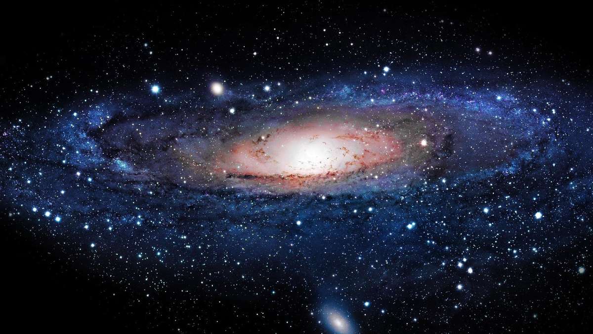
That's just it the money IS being spent on worthwhile things unlike looking up at the stars, the iss and sending a roadster into deep space. So the big bang created the very thing that it needs to even exist? Yeah makes perfect sense. The big bang and it's concept falls apart very easily. With science I see alot of assumptions. We assume the constants today like gravity have always been the same. That's simply not been proven, nor are we able demonstrate FACT! Things do not create themseleves from nothing. You can't get everything from nothing, nor has this been proven or demonstrated. Gravity also isn't what we think it is. Scientist looking at galaxys notice stars close to the centre (or closer to the mass as that's what's keeping all the stars in orbit) rotate exactly the same speed as those furthest away from the centre. But surely those stars on the outer edge are further away from the centre mass so the gravitational force must be less? And yet the galaxy is seen to all be spinning like a precision time piece with order, regardless of the gravitational forces we can test and proven thus far. Hhmmmmmman unlining force that governs everything, something all around us and allows for life on earth. A very mystical force that's authority seems to be above all else. Funny that lol How is it possible or demonstratable that the below in any permutation can create consciousness? Not what we see but able to scientifically test and replicate? And to be presented as proven fact? Have more chance of setting of a explosion in a print shop and an English dictionary being created word for word as we have it today. Again science is left wanting to me and is more mambo jumbo than factual sadly when dealing with the origins of life or anything else in the night sky. I guess when stars are sometimes visible in space and then sometimes not (as said by many astronauts #contradiction) it can be difficult to examine. Accepted theories are then piggy backed with other theories and before you know it we have string theory - the ultimate piggy back. Which doesn't account for or even begins to answer the questions of reality, the why or dark matter nor will it ever.
-
That's commitment in this weather, looks smart!!
-
$1.2tn figure by estimating the value of religious institutions, including healthcare facilities, schools, daycare and charities; media; businesses with faith backgrounds; the kosher and halal food markets; social and philanthropic programmes; and staff and overheads for congregations. Yep pretty demonstratable lol yep wipe all that wasteful mambo jumbo away. Shame on them for wanting education, food, shelter, charity and health care. Any advances on which came first the big bang or gravity? Surely this information and the understanding of this is key to everything we see before us?
-
Got a link to that, as those figures make no sense. ------------------ Im learning which is good, question. Its said the big bang and what happened thereafter is all possible due to the laws of gravity. So did this event create gravity? Did the event create the very thing that made itself possible? Yes or No. Big Bang is what you believe, so no need to go off and research right?....... seems a fairly basic question?
-
How about that time and effort looking up be used to help one another?............ radical right lol Science is great no doubting, but to view it as the leading authority with regards to reality is lacking imo. The scientific community believes is what we cant see, test or replicate and faith in parts is no different. It really isn't one verses the other to me, one doesn't weaken or strengthens the other. Dark matter projects, CERN, D-Wave all trying to understand the fabric of our reality - you're absolutely right, science will get there.
-
If the big bang is thought to be fact, surely we'd have a clear understanding of the cosmos. So if the universe is expanding, so something expanding in to and filling the void......... is that void nothingness? Or something?
-
Question, Is the universe infinite?
-
Nice one pal, I'm IN Payco - Mark 2 Nismo 370z davey_83 - 350z
-
Yea fair play to him, this seems pretty high.
-
Nice one lads
-
Nice heads up fella
-
welkom back to JAP, looks stunning pal
-
10mm
-
I like everyone else really hopes this isn't a prelude to something larger.
-
How does a timely fire in a busy Kemerovo shopping centre grab you............ http://www.bbc.co.uk/news/world-europe-43531684
-
When you're on top, be humble. How many times does he have to learn the hard way lol 'what goes round, comes round'
-
Lewis is grade A knob