

davey_83
-
Posts
7,178 -
Joined
-
Last visited
Content Type
Profiles
Forums
Events
Gallery
Store
Everything posted by davey_83
-
Neat work, I like that - kidda cosy
-
Cheers Tom, yep gunked up pretty bad on the one side lack of v-tech yO! Noticeably smoother idle now and no hesitation rolling on/off throttle, no doubt causing an adverse effect on general performance too. Yeah saw that episode, fairly common thing from what I gather too for those engines.
-
eBay pal
-
If Carlsberg made thread updates Such a small mod but doesn't the gearshift extended really help? I've removed it a couple times and lasted not even a day before putting it back on haha
-
1. 14N - Paid 2. Panman - Paid 3. Valy - Paid 4. Conlonl 5. Veilside Z - Paid 6. G1en@waxandshine - Paid 7. Pintopete58 - Paid 8. Cob1980 - Paid 9. MaxZ - Paid 10. SHEZZA 11. zebedy - PAID 12.Buster - PAID 13.glrnet - PAID 14. davey_83 - PAID 15. Humpy - Paid 16. Brophy_3fiddy - PAID 17. Dean.B - Paid 18. 19. 20.
-
Performance robbing plugs be gone Underbody and arch's look AMAZING!!!
-
All the best for tomorrow for anyone looking to venture out, have a good time and stay safe
-
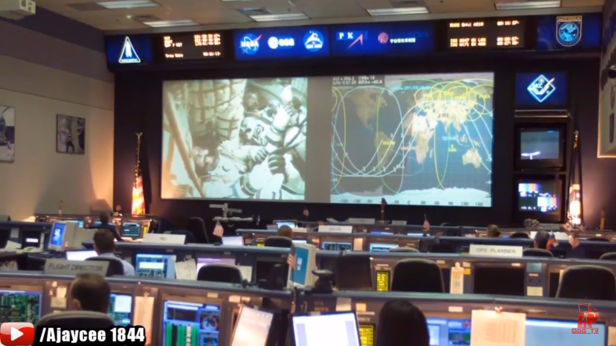
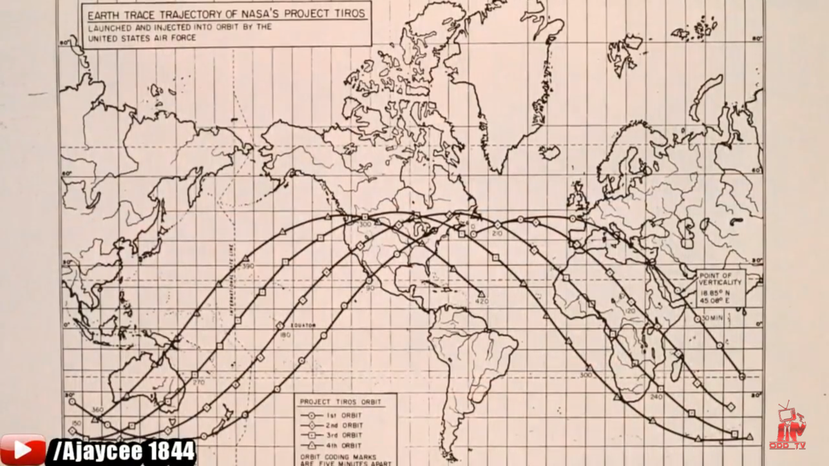
What do these pictures show? We've all seen them. Did it ever seem weird the path rockets and anything orbiting the globe take? You know where I'm going with this, hands up who thinks these paths will make more sense on a globe compared to a flat plain......... Just for giggles.
-
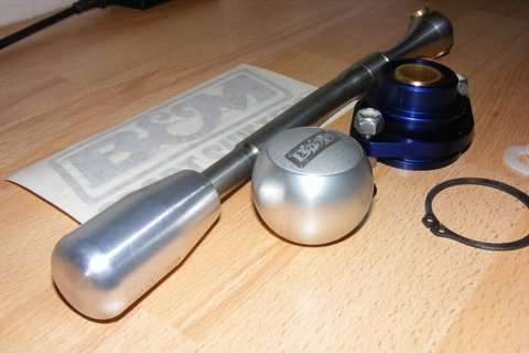
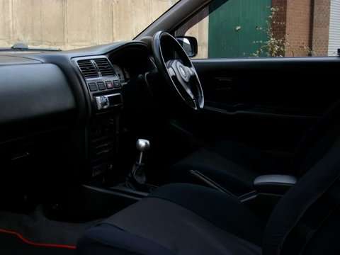
With ANY used car purchase, you have to drive a few examples to tell a good'un from a duffer. And yes, it feels as good as it looks B&M shifter knob cicra 10yrs I've had it, pretty rare even back then. Had it in ol' Almera GTi.
-
Plus, spec wise you can over time change the car to what you want. Ie seats, wheels, lights, exhaust, body kit. Best to start with a clean staright example and go from there. Plus it won't be something someone else had, it'll be unique to you and fun modding along the way too.
-
For me the HR bonnet is functional and Nissan used it as they had too. Sleeker DE profile is win imo, same for the front bumper overall.
-
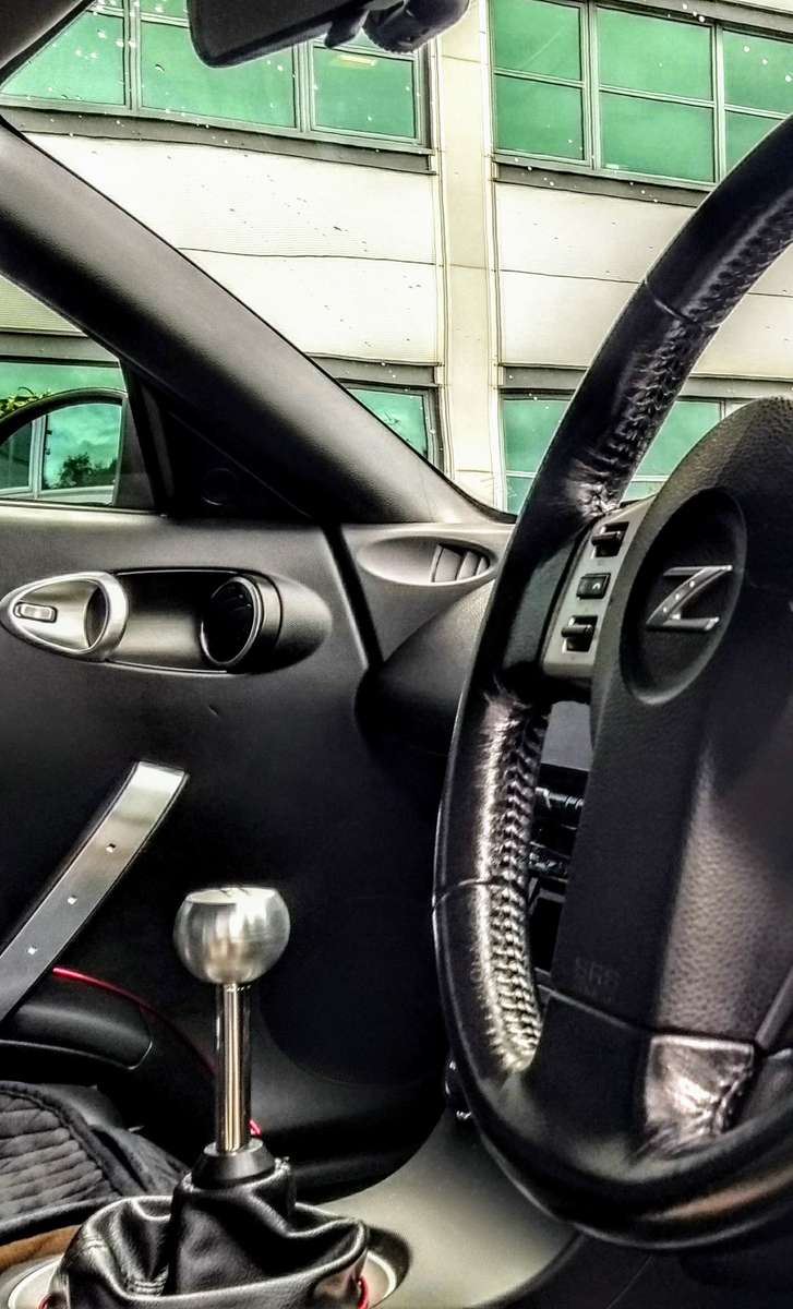
Best way is to drive a few more and find out for yourself. Various things can improve the shifter feeling, fresh gearbox oil, replace the worn diff bushes, adjust the gear shifter plate under the gear knob gaiter. I went with diff poly bushes & a gear shifter extender, which make shifting gears a breeze.
-
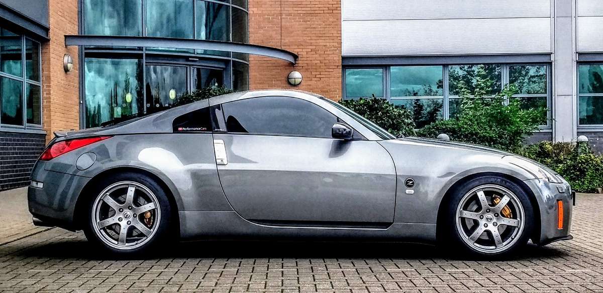
Which 350z do you have?
-
Ello n welkom, nice car
-
Someone who believe in the Big Bang........
-
Ahhhhh I tried to keep away from door number 3 - religion haha. not offended a tiny bit Dan, I do present my understanding and thoughts truthfully which I can stand by. Im trying to approach the matter as if I had been living under a rock for 34yrs effectively resetting what I've been told and working out ALL views for myself. Casein point, those of you will know I've come of FB. I found it really addictive, wake up check fb, last thing before bed check FB. I've been off FB since 1st of January and honestly apart from not know anyone's birthdays I haven't missed it. Wanted to see how I felt without it for the first time in 6/7 yrs, tbf I'd never know until I tried. No doubt I will go back on however at present I'm good. We all know I'm a creationist if that's the right word. With my free time from not being on FB, to help me understand what I think in believe I'm reading the bible for myself. Rather than hearing other people's interpretation of the word, I figured I'd go at it myself - currently up to 2nd chronicles and enjoying it. Again I find FE debates funny, it shouldn't last 5 mins. What I'm selfishly doing is bleeding it for information as the concept is so ridiculous. PS I didn't understand the question sadly Dan. I don't know what that is........ so easily dismiss potentially conflicting scientific theories offering alternative evidence
-
Yeah I know, too bad Captain James Cook couldn't LOL
-
I don't understand how anyone can see what NASA says about stars and accept the BS, they don't even stick to that same story. The galaxy is set in motion and from our perspective, does it own thing. We can only view what's going on out there, observe and document nothing more. Yet conflicting statements come out about being able to view stars from from space lol I'm actually chuckling, they've done a good job - fair play.
-
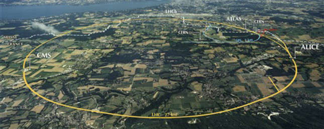
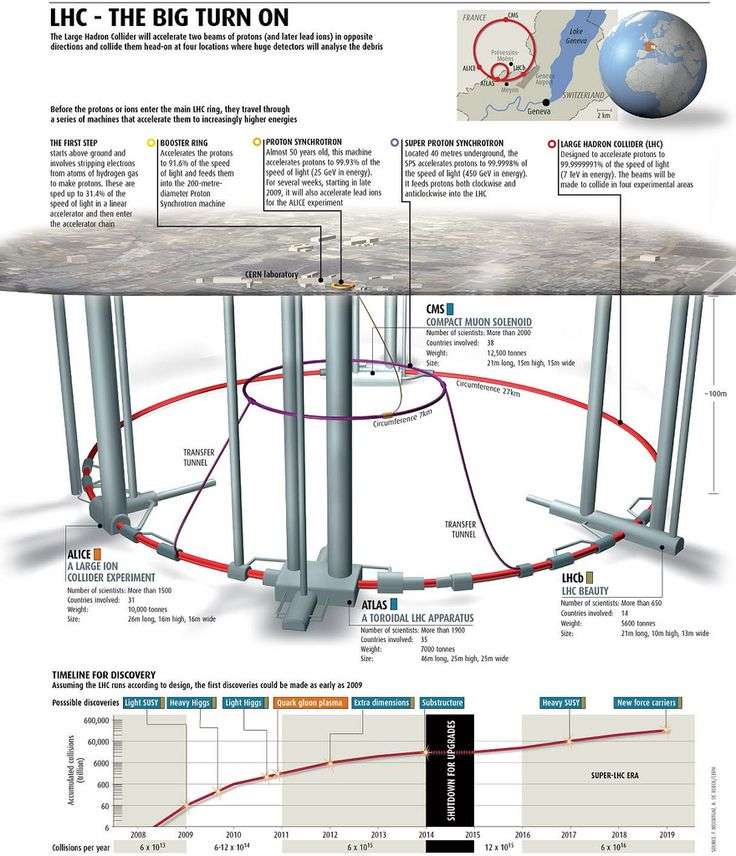
Haha exactly Dan, NASA is supplying the sand. No body of water has ever been tested to show a curve, should be pretty easy to show otherwise. Science presents a flat plain. Do we think the shape of Cern underground is a flat circle or does it contour to follow earths curves? Do we think the stations around on the land go straight down to link with the LHC or taper as they go down? I doubt it #owngoal
-
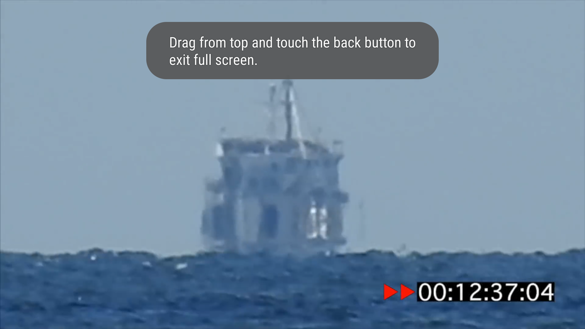
Haha back to work you!! If you watched all of the video and see that the bottom fell below a curve. Then no amount of visual data will present a flat plain. It's refraction which would continue from the waters edge upwards. You can clear see the distortion in the second picture of the boat, this distortion simply continues as the object gets smaller. The mast inst going lower, it's getting smaller as it goes further away. Furthermore the mast at no point appears to tilt away from view as one would expect as it went over the curve. wow a floating boat, cool.


-
However is space a vacuum or zero pressure? All makes sense however we are told the ship goes over the curve, ie where is this evidence? The video I linked clearly demonstrates otherwise. Where is the proof? Yes I know it's meant to it's what we are told, but in the real world this isn't visible or testable. If you've ever looked into rear axle bending, you have to physically over end the mental to get it to the desired geometry. It's what folks use to do to get around the factory toe in. I'd need to know the measurements for the bridge above sea level at the ends and middle to even entertain why the towers are further apart at the top than the bottom. However at a glance, If the actual hight of the road is higher in the middle than the ends, it's would make sense for the towers to lean back helping to maintain the desired elevation.
-
What is there to expect from a roadster in space? I've felt from the start it's pointless in the grand scheme of things. You are correct. No need for the space rover in the day, could have just used a open top defender with an electric motor. It's not real is what I believe or beginning to believe. What do you make of the statements about viewing stars from space? Again ships do not go over a curve, sorry to sound like a broken record they just don't. Once this fact clicks into place #houseofcards
-
Musk states basically nothing changed to the roadster prior to sending it in space. What are the seats made from? Basically metal frame, recycled materials, foam, leather and fabric to clip/join to the frame. What do you think would happen to foam in the vacuum of space? Foam has what inside of it, air. Think about it what you are seeing, the seats still look plump and unchanged. I personally think it's insulting and a shame.